
Published 15.11.2021
Digital Imaginaries of the Pandemic‑Resilient City
Keywords: COVID-19 ; pandemic-resilient; digital imaginaries
Abstract:
Planning is a form of imagination, and the COVID-19 pandemic has both solidified and loosened it. Pandemic responses such as locational track and trace, facial recognition tracking, and machine-learning renew forms of top-down surveillance. Yet the pandemic also witnessed new forms of thinking: the digital right to the city, reclaiming public space and roads from cars, low-traffic neighbourhoods, slow streets, green spaces, and better cycle lanes. In this contribution, I explore how digital geolocational technologies can build the pandemic-resilient city.
Drawing on an alternative imaginary grounded in slow AI I assert that it is time to think big by learning from the COVID-19 pandemic to build safe, equitable activity spaces and geographies. I assess how innovative digital spatial technologies and human-in-the-loop geographic machine learning can capture, map, and analyse positive changes, and how geographic technologies can help build a radically resilient city.
COVID-19 and the city
The global COVID-19 pandemic has had profound effects for health, wellbeing and flourishing. Not least however have been implications for how urban areas and cities can become places that are more resilient to future recurrences, mutational variants that escape the vaccines, or lag times in vaccination programs globally. After more than six months of the world’s largest vaccination rollout, only about 20 per cent of people globally had been fully vaccinated, with some countries in Africa, Asia and South America barely getting started. While vaccinations are a key part of the public health response, they are insufficient in themselves, given that COVID-19 is only the latest in a series of viral pandemics and epidemics. The main reason for this is that infections are not solely governed by vaccines but also by social-economic conditions. In the United Kingdom (UK), which had one of the world’s quickest vaccine rollouts (mostly because it failed to meet its international obligations to share supplies), the delta variant ripped through the country in summer 2021, while at the same time the government ended rules on social distancing and mask wearing at a time when only 50 per cent of the population were fully vaccinated.
So how can planners and local communities leverage digital geotechnologies to make urban areas safe, flourishing and integrated with green and degrowth planning? Such an approach places geolocational technologies as part of a wider approach linking three critical issues too-often imagined separately: climate change, COVID-19, and urban planning – especially the transition from car dependency to active travel (walking and biking for transport). These three issues are linked together in complex ways. For example, there are interactions between COVID-19 transmission via aerosols that attach to pollutants which come from vehicle emissions (carbon monoxide) and particulate matter emissions from vehicle tyres and other moving parts (Comunian et al. 2020). Therefore, addressing the causes of global climate change by reducing airborne pollutants will help prevent viral transmission, in concert with mask-wearing indoors or in crowded spaces to prevent respiratory droplet transmission. If this reduction is attained via more sustainable and healthier transportation and mobility options, it will also mean safer forms of human mobility.
In April 2020 the World Health Organisation (WHO) recommended the installation of thousands of kilometres of cycleways across Europe to not only reduce traffic congestion but deliver billions in health benefits (Reid 2020). A recent study revealed that up to 60 per cent of pavements in UK cities were too narrow to allow socio-spatial distancing of two metres, as recommended by medical experts to prevent SARS CoV-2 droplets from infecting other people (Robson and Ford 2020). However, as New York City’s Transport Commissioner has pointed out, the narrow width of pavements is not because there is not enough space, but because up to 80 per cent of public space in cities is devoted to streets (Sadik-Khan and Solomonov 2020). As they point out, part of the problem is the perception that urban roads and streets are only for cars, or that cars have total dominance, even though various studies have shown that cars spend most of the time parked. A 2012 study in the UK for example found that cars were parked for over 96 per cent of the time (Bates and Leibling 2012), and UK government statistics indicate that prior to the pandemic people are in cars on average just 35 minutes a day (UK Government Department for Transport 2020). Parking not only narrows pavement widths, but also prevents installation of bicycle lanes, curbside dining, and pedestrianization (e.g. play streets), as well as removing millions of front gardens. Have we got the wrong priorities for human mobility in order to be resilient to COVID-19?
To answer this question, we can establish the notion of the pandemic-resilient city, in place of the often stated alternative, the post-pandemic city. The latter assumes that we will return to normal at some point. This assumption is both unsafe and a wasted opportunity to learn from the ways our lives have been radically transformed. Returning to normal is neither possible nor desired as it was the situation that created tremendous inequities during the pandemic at its heights. Resilience means not just overcoming but learning from adversity. Our activity spaces need to build back better, not just recover; to resiliently bounce forward instead of back to normal.
To implement the pandemic-resilient city, we need to know more about a couple of key challenges at the intersection of urban design and mobility. Where and what types of spaces were changed or adapted to the pandemic, and how did mobility change? Second, how can local residents play a constructive role in building a more resilient city? Although it is true that we know some of the answers, we are still far from understanding how to implement, never mind measure, the successful pandemic-resilient city. Fortunately, there are geospatial tools and technologies that can provide insight. In what follows, we will briefly discuss and exemplify these technologies in order to see how they can contribute to digital citymaking. And we will consider a novel alternative called Slow AI that could provide a preferable approach to building the pandemic-resilient city.
Using geospatial technologies to learn from pandemic-prompted urban adaptations
First, where and what types of spaces were adapted in response to the pandemic? In mobility terms, a good example is low-traffic neighbourhoods (LTNs). An LTN is where a residential road is re-prioritised away from cars and on to other forms of transport such as walking and cycling. Roads are historically accepted as being primarily for vehicles, and travel by private vehicle is considered a freedom and even a right. LTNs are relatively inexpensive, often being created by moving heavy planters or bollards across the entrance and exits of side roads or small bridges to create modal filters which allow some forms of traffic to pass through but not others. Although they existed prior to the pandemic, LTNs were implemented very quickly in hundreds of local residential streets in the UK and were made possible by emergency planning legislation that gave local councils greater powers. An LTN reimagines the use of the space for other alternatives, such as a play street, for walking and bicycling, community gatherings and street festivals, and for the removal of parked cars. A similar scheme has been implemented in Barcelona, known as superilles (superblocks), comprising nine city blocks which only allow regular traffic around the perimeter. Within the block only local deliveries and residents are allowed and can travel only at the slow speed of 10 Kilometres per hour.
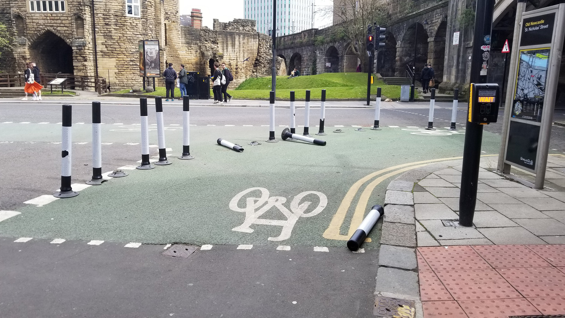
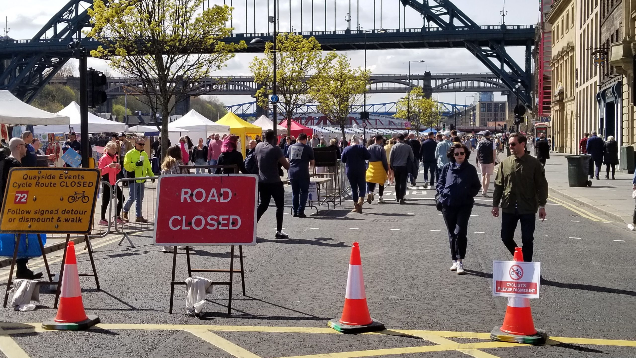
The well-known Dutch model switched in the 1970s from a car dependent culture to one that provides some of the most plentiful active travel urban infrastructure with over 22,000 miles of cycle paths, and where more than 25 per cent of all trips are made by bicycle compared to just 2 per cent in the UK (see Figure 1). The reasons for this switch are complex, and it did not occur without a struggle, but one of the factors was that Dutch cities instituted a practice of car-free Sundays, which gave people a taste of the possibilities and possibly changed attitudes. If done right, for example permitting a pop-up market in the closed street, pedestrian presence can radically be increased (see Figure 2).
LTNs have not been universally welcomed in the UK, with all sorts of objections being raised – drivers will have to circle more to find parking, that cars are displaced on to other roads causing pollution, and that they only benefit wealthier middle-class suburbs at the expense of working-class neighborhoods. As it stands there is insufficient empirical evidence to convince opponents, even if preliminary evidence points towards greater benefits and fewer disadvantages (or at least the disadvantages invoked by opponents) of LTNs. However, this does not mean they should not be implemented. As noted in one LTN study:
„As a low cost and easily implementable solution, LTNs can contribute to much needed fast urban transformation and radical reimagining of what - and who - public space is for, and help meet broader environmental goals.“
(Aldred and Verlinghieri 2020: 56)
to gather at the pop-up market. Source: Author.
to gather at the pop-up market. Source: Author.
Geospatial technologies can contribute to better planning of LTNs and their effects; whether by mapping LTNs to examine distribution patterns, or more spatial analytical approaches such as modelling where traffic flows will be redistributed, or how LTNs correlate with socially deprived areas using census data. One approach, commonly seen in the smart city context, is to deploy sensor networks and urban dashboards that collect and visualize the data for simulating urban conditions and changes. For example, geospatial methods such as spatial agent-based models (SABM) can draw on these sensor systems to provide realistic predictions because they can model complex systems in heterogenous situations as a process over time (for a methodological review see Manson et al. 2020). Spatial ABMs model and predict the behaviour of individual agents (e.g. vehicles) rather than making more aggregate predictions such as density of traffic per unit area at a given time. Because they model how these agents behave and interact, they are capable of demonstrating “emergent” or self-organising behaviours and therefore are less deterministic, although still rule-based. A classic example is John Conway’s Game of Life, which has four simple rules governing the behaviour of cellular automata on a gridded surface (for an online version, see https://playgameoflife.com/). Conway’s model exists on a 2D gridded surface, but SABMs are capable of operating at multiple scales – both spatial and the amounts of data afforded by Big Data, although challenges remain for implementation of the latter.
These models, known as stochastic models because they incorporate elements of randomness, are often computationally intensive and like many other algorithmic and deep learning approaches can be environmentally detrimental because they often need to run for days or weeks at a time on dozens of processing units (Strubell et al. 2020). Additionally, installed sensors tend to cover only a small proportion of the areas we may be interested in, and are especially sparse in non-urban areas or regions outside the global north. Mattern (2015) in her history of the urban dashboard shows that perhaps with the exception of the famous Cybersyn project implemented by Chile’s leader Salvador Allende in the early 1970s, nearly all examples of the form come from data-rich western countries.
Examples such as these have prompted a search for less energy-intensive, and less surveillant approaches. One such is the concept of Slow AI inspired by other slow movements such as slow food, slow scholarship and slow computing (Kitchin and Fraser 2020). Slow AI is not a computer programme, code base or github repository, rather it is a technological imaginary that can be used in STEM, SHAPE (social science, humanities, the arts for people and the economy) as well as urban planning (Crampton 2020). Why slow? Whereas the motto of the gung-ho tech-bro era was “move fast and break things” (often attributed to an informal slogan at Facebook) the slow approach urges more caution to resist the unreflective application of AI that may not be needed. Going slow also means minimizing technologies, to avoid the black box solutionism where the technology takes over decision-making. Instead, a human-in-the-loop methodology can be employed where technology can be used to make suggestions but where people do the decision-making.
An example is the appropriately named Slow Ways project started in the UK in 2020. Slow Ways used geospatial technologies to identify a network of possible walking routes between populated places in the UK that avoid roads. After the routes were proposed volunteers walk the routes to assess and review them for suitability, attractiveness, access problems. Such a spatial crowdsourcing approach, sometimes known as volunteered geographic information (VGI), both keeps people in the loop, and helps scale up the solution.
Slow Ways could have used machine learning, for example scanning high-resolution imagery, but found that they did not need to – the 100,000KM of routes were created by a distributed team of about 700 people during lockdown (80,000 have volunteered to test the walks). Sometimes however the data sets are so large that some form of automation is necessary. What then? Huck et al. (2021) offer an attractive solution using a combination of crowdsourcing (VGI) and machine learning. To address the challenge of poorly mapped parts of the world, they proposed and developed a hybrid system they call Centaur GIS after the half-human, half horse mythical creature. In their system tested in northern Uganda, they used a human-in-the-loop approach integrated with ML, rather than a purely ML system, to add features to OpenStreetMap (OSM). OSM is an open-source mapping project that typically is created by users around the world with direct knowledge of the local area they are mapping, and has the goal of being an open, non-commercial, and deeply detailed world map.
Although a laudable goal on its face, OSM contributors and editors are highly sceptical of pure ML approaches to automatically add data and have so far resisted efforts to do so. Centaur GIS proposes to resolve this tension by using ML to search for and identify candidate additions to the map, first in terms of its geometry (e.g. its shape, area and location) and then in terms of its identity (house, school, road and so on). In response, human users review and edit geometries and classified features, before approving and submitting to the OSM master database. The OSM interface could be adapted to accommodate Centaur GIS methods and make it available to the OSM community worldwide, while meeting the demands of keeping human decision-making a priority.
Such a hybrid approach is not against technology in the same way that slow food is not against eating, or slow computing is not against computation (Kitchin and Fraser 2020). But at the same time, the technology should not be a free-floating technique that is applied universally without consideration of local context and, just as importantly, local meanings of place. This is because AI is often developed as a universal tool without sufficient consideration of how it “travels” (McDuie-Ra and Gulson 2020) and whether the ML parameters can transfer from one place to another.
All too often, big data suggests big analysis which these days often means sweeping machine learning. In Chen et al. (2021) for example, the authors propose to use CCTV footage to assess busyness during lockdowns and afterwards, by identifying from real-time footage the vehicles, pedestrians and other occupants of streets, as well as classifying features of the street scene (shops, bus stops, greenery and so on). While this is an innovative and promising technique, which the authors cite as being in experimental use by the UK government’s Office of National Statistics, it cannot speak to the meaning of life on the street, or ascertain people’s sense of place and lived experience. Pedestrians are reduced to a single pixel which does not capture how they feel about the space they are in (for example, how safe it is for them), their values and preferences, their sense of belonging, or whether the space is adequate to their needs.
A pandemic-resilient future
In August 2021 the World Economic Forum (WEF) released a widely-noticed video which asked “What pandemic-era changes would you like to become permanent?”. Their answer comprised food home delivery, masks and sanitizer gel, Perspex office spaces, lasers to monitor heartbeats for identification, and endless screen time for learning and work (Cunliffe 2021). As critics pointed out, these proposals are less concerned with human flourishing and more concerned with creating markets. They are also not the adaptations that people most likely want or prefer. Unfortunately, unless we counter such imaginaries they may come to pass under the assumption that we can return to normal. In the UK vehicular traffic levels reached 94-109 per cent of pre-pandemic levels during the summer, after dropping to as low as 25 per cent normal during lockdown (UK DfT 2021). These levels are not sustainable given the environmental costs and health inequities such as air pollution that they produce.
How could geospatial technologies – following the Slow AI model – provide a better imaginary for digital citymaking? First, is the prioritization of maintenance over innovation, as discussed by Vinsel and Russell (2020). Innovation has all too often been an unexamined justification for almost any kind of disruptive change, without considering who or what is being disrupted, or the consequences for people of that disruption. Vinsel and Russell argue for an approach grounded in repair, maintenance and care for what we have. In terms of urban planning this could mean making public space more widely accessible, including streets:
The aim of LTNs would be not just to reduce motor traffic by a certain percentage,
(Aldred 2020)
but to change the character of those streets such that their entire width is usable by all,
not just by those in motor vehicles.
Slow AI-style geospatial technologies would proceed carefully, especially ensuring that data quality is assured to avoid the pitfall of many automation technologies that fail due to unreliable data or that are tested on the same data they are trained on. This means paying down what is sometimes called the technological debt of testing the model to understand its downstream effects, cleaning up the data (a tedious and unglamorous activity), and collaborating with others rather than reinventing the same model with a slight tweak. A key component of such care is working openly, and making the assumptions and tools available for sharing and collaboration, rather than in a closed or corporate space where model parameters are hidden behind non-disclosure agreements (NDAs). The pandemic-resilient city is also one that could learn what its residents want to keep them safe, rather than the WEF model of extending lockdown conditions into the future. This is not news to planners, who have long advocated citizen-centered planning or co-design (Wilson and Tewdwr-Jones 2022). Nevertheless, it is still relatively uncommon because it is difficult to train people in the planning process, and there has been very little work done on preferences and visioning. One promising solution is to use a gaming approach, as practiced by UN Habitat who work with the Block by Block Foundation using the popular Minecraft game. Participants can be taught how to use this game in less than a day, and it has been used to make cities more gender-equitable and safer for women and girls (UN Habitat 2020).
Second, it is evident that interventions towards the pandemic-resilient city such as LTNs are best implemented in “joined-up” fashion; that is, when their spatial externalities and downstream effects are anticipated and incorporated. Different fields label this by different names, but what they amount to is a systems approach. This implies a place-based approach, and a contextual understanding of what specific local factors are important in fostering resilience. For example, in the developing world access to public space is critical for informal markets, and pollution might be caused by vehicles as well as open waste burning. Similarly, an evaluation of the success of an LTN would not just examine the effects internal to the LTN (e.g. reduction in vehicular accidents) but also look at the displacement of vehicles and resulting congestion in surrounding areas, if any. Consequently, planning the pandemic-resilient city means taking a big picture approach, as well as local change such as getting planning permission for a single change (e.g. a conversion of parking lane into bicycle lane, or taking away some parking spots to put in a parklet). In that sense we can build better models that are local – Slow AI that is not built as a universal and then “tuned” locally but built up around local place-based values. Again, local engagement is critical here, but all too often it occurs only within strictly defined parameters in accordance with policy requirements, what planners deem relevant, and legal obligations (Wilson and Tewdwr-Jones 2022). Where there is scope for local or neighbourhood planning groups however, they can be effective, especially if they make evidence-based decisions and incorporate evidence in a systems manner (in the UK, many issues are excluded such as speeding, local values, sense of place) that arguably are relevant to the planning process. A systems approach that widens citizen participation from the start can be facilitated by relatively inexpensive but imaginative geospatial technologies such as “spray-can GIS” (Huck, Wyatt, and Coulton 2014) which alleviates the requirement for members of the public to learn specialist planning terms or regulations. In the spray-can methodology, participants use the mouse as a digital spray-can to spray digital dots on a map. Each dot is saved, and tied to participant demographics (age, sex, religion etc.) to capture what they feel about the place (e.g. safety, attractiveness, or busyness). The more dots the participants spray, the stronger their feelings. Such a method could be implemented alongside the Minecraft urban visioning noted above to produce both maps of values and suggestions for better urban conditions.
Finally, Slow AI also has an exit strategy, so it can gracefully decompose after use, and not leave in place surveillant systems that become re-tasked for other purposes. There are a number of good reasons for this, including the fact that data collection and monitoring technology has historically been shown to exhibit surveillance creep or extension of its use beyond its initial application (the term probably comes from the military phrase mission creep to describe an extension from the original mission plan). Video doorbells such as Ring are an example, with an original purpose being to locally record and observe the owner’s front door; the company now supplies video feeds to police departments. Where surveillance creep occurs, it can erode privacy by normalizing surveillance, and diminish autonomy (Selinger and Rhee 2021). But we should also be mindful that technology comes with an environmental cost; indeed AI has often been conceived as an extractive industry – not just in terms of extracting personal data from people, but in terms of mineral and energy extraction and consumption. As Crawford points out, AI can often seem like an abstraction, but it has physical demands from the lithium needed in batteries for electric cars, data center power, and smartphones (Tesla is the biggest consumer of lithium-ion batteries globally), and it has physical emissions that contribute to global climate changes (Crawford 2021). Many consumer devices have a short lifespan – Crawford cites the fact that the average smartphone is used for less than five years – which only adds to the extractive nature of technology in its speeded-up search for the new. A Slow AI is cautious and suspicious of innovation if there is already an adequate alternative and like the art conservator would never implement something that could not be undone later on.
These three Slow AI style approaches – maintenance and care; joined up systems planning with citizen engagement; and minimalization, are a set of powerful imaginaries for digital citymaking, and give a powerful indication of the ways that geospatial technologies that can foster more resilient cities.
References
Aldred, Rachel (2020): Low Traffic Neighbourhoods: what is the evidence from the mini-Holland interventions? http://rachelaldred.org/research/low-traffic-neighbourhoods-evidence/, accessed: 18.08.2021.
Aldred, Rachel and Verlinghieri, Ersilia (2020): LTNs for all? Mapping the extent of London’s new Low Traffic Neighbourhoods. Westminster University Active Travel Academy report. https://tinyurl.com/4d33psxd, accessed: 11.11.2021.
Bates, John and Leibling, David (2012): Spaced Out. Perspectives on Parking Policy. London: RAC Foundation. https://www.racfoundation.org/wp-content/uploads/2017/11/spaced_out-bates_leibling-jul12.pdf, accessed: 05.07.2021.
Benjamin, Ruha (2019): Race After Technology. Abolitionist Tools for the New Jim Code. New York: Polity.
Chen, Li; Grimstead, Ian; Bell, Daniel; Karanka, Joni; Dimond, Laura; James, Phil; Smith, Luke and Edwardes, Alistair (2021): Estimating Vehicle and Pedestrian Activity from Town and City Traffic Cameras. Sensors, 21, 4564. DOI: 10.3390/s21134564.
Comunian, Silvia; Dongo, Dario; Milani, Chiara and Palestini, Paola (2020): Air Pollution and Covid-19: The Role of Particulate Matter in the Spread and Increase of Covid-19‘s Morbidity and Mortality.“ International journal of environmental research and public health 17 (12): 4487. DOI: 10.3390/ijerph17124487.
Crawford, Kate (2021): Atlas of AI. Power, Politics, and the Planetary Costs of Artificial Intelligence. New Haven and London: Yale University Press.
Cunliffe, Rachel (2021): The Davos man’s vision of a post-Covid-19 world makes my skin crawl. New Stateman, 19 August. https://www.newstatesman.com/business/work/2021/08/davos-man-s-vision-post-covid-19-world-makes-my-skin-crawl, accessed: 19.08.2021.
Huck, Jonathan; Perkins, Chris; Haworth, Billy T.; Moro, Emmanuel B.; and Nirmalan, Mahesh (2021): Centaur VGI: A Hybrid Human–Machine Approach to Address Global Inequalities in Map Coverage, Annals of the American Association of Geographers, 111: 1, 231–251.
Huck, Jonathan; Whyatt, and P. Coulton (2014): Spraycan: A PPGIS for capturing imprecise notions of place. Applied Geography 55:229–237. DOI: 10.1016/j.apgeog.2014.09.007.
Kitchin, Rob and Fraser, Alistair (2020): Slow Computing. Why we Need Balanced Digital Lives. Bristol: Bristol University Press.
McDuie-Ra, Duncan and Gulson, Kalervo (2020): The backroads of AI: The uneven geographies of artificial intelligence and development. Area 52 (3): 626–633. DOI: 10.1111/area.12602.
Manson, Steven; An, Li; Clarke, Keith C.; Heppenstall, Alison; Koch, Jennifer; Krzyzanowski, Brittany; Morgan, Fraser; O‘Sullivan, David; Runck, Bryan C.; Shook, Eric and Tesfatsion, Leigh (2020): Methodological Issues of Spatial Agent-Based Models. Journal of Artificial Societies and Social Simulation 23 (1): 3. DOI: 10.18564/jasss.4174.
Mattern, Shannon (2015): Mission Control: A History of the Urban Dashboard. Places Journal. https://placesjournal.org/article/mission-control-a-history-of-the-urban-dashboard/, accessed: 18.08.2021.
Reid, Carlton (2020): Pop-up Coronavirus Cycleways Deliver $3 Billion in Annual Health Benefits across Europe. Forbes Magazine, August 18th. https://bit.ly/3tjv7Ik, accessed: 11.11.2021.
Robson, Craig and Ford, Alistair (2020): Can geospatial analysis help with social distancing during the COVID-19 pandemic? https://craig-robson.github.io/pavement_maps/, accessed: 11.11.2021.
Sadik-Khan, Janette and Solomonov, Seth (2020): We Must Rethink our Streets to Create the Six-Foot City. The Guardian, September 4th. https://www.theguardian.com/cities/2020/sep/04/janette-sadik-khan-we-must-rethink-our-streets-to-create-the-six-foot-city, accessed: 11.11.2021.
Selinger, Evan and Hyo Joo Judy, Rhee (2021): Normalizing Surveillance. Sats 22 (1): 49–74. DOI: 10.1515/sats-2021-0002.
Sieber, Renee and Crampton, Jeremy W. (2021): Possibilities of a Critical GeoAI. Paper presented at the American Association of Geographers Annual Conference [Online Seattle, Wa.]. https://aag.secure-abstracts.com/AAG%20Annual%20Meeting%202021/abstracts-gallery/50621, accessed: 05.07.2021.
Strubell, Emma; Ganesh, Anaya and McCallum, Andrew (2020): Energy and Policy Considerations for Modern Deep Learning Research. Proceedings of AAAI Conference on Artificial Intelligence, 34(09), 13693–13696. https://ojs.aaai.org//index.php/AAAI/article/view/7123, accessed: 18.08.2021.
UK Government Department for Transport (DfT) (2020): National Travel Survey 2019 Data Table NTS0101. https://www.gov.uk/government/statistics/national-travel-survey-2019, accessed: 05.07.2021.
UK Government Department for Transport (DfT) (2021): Transport use during the coronavirus (COVID-19) pandemic. https://www.gov.uk/government/statistics/transport-use-during-the-coronavirus-covid-19-pandemic, accessed: 18.08.2021.
UN Habitat (2020): Her City. A guide for cities to sustainable and inclusive urban planning and design together with girls. Nairobi: UN HABITAT.
Vinsel, Lee and Russell, Andrew L. (2020): The Innovation Delusion. How our Obsession with the New has Disrupted the Work that Matters the Most. New York: Currency Books.
Wilson, Alexander and Tewdwr-Jones, Mark (2022): Digital Participatory Planning: Citizen Engagement, Democracy, and Urban Design. New York: Routledge.